

Adventure
Where to Play
Surrounded by stunning landscapes, Dunsmuir is the perfect headquarters for outdoor exploration. As the gateway to the Siskiyous, our town offers easy access to rugged mountain trails, cascading waterfalls, snowy peaks, and pristine rivers. Hike through lush forests, cast a line in world-class fishing spots, or simply take in the breathtaking views at Dunsmuir Botanical Gardens. From adrenaline-pumping river kayaking to quiet moments on a woodland trail, the natural beauty around Dunsmuir offers something for every interest and ability.
pictured above: Castle Crags State Park
-
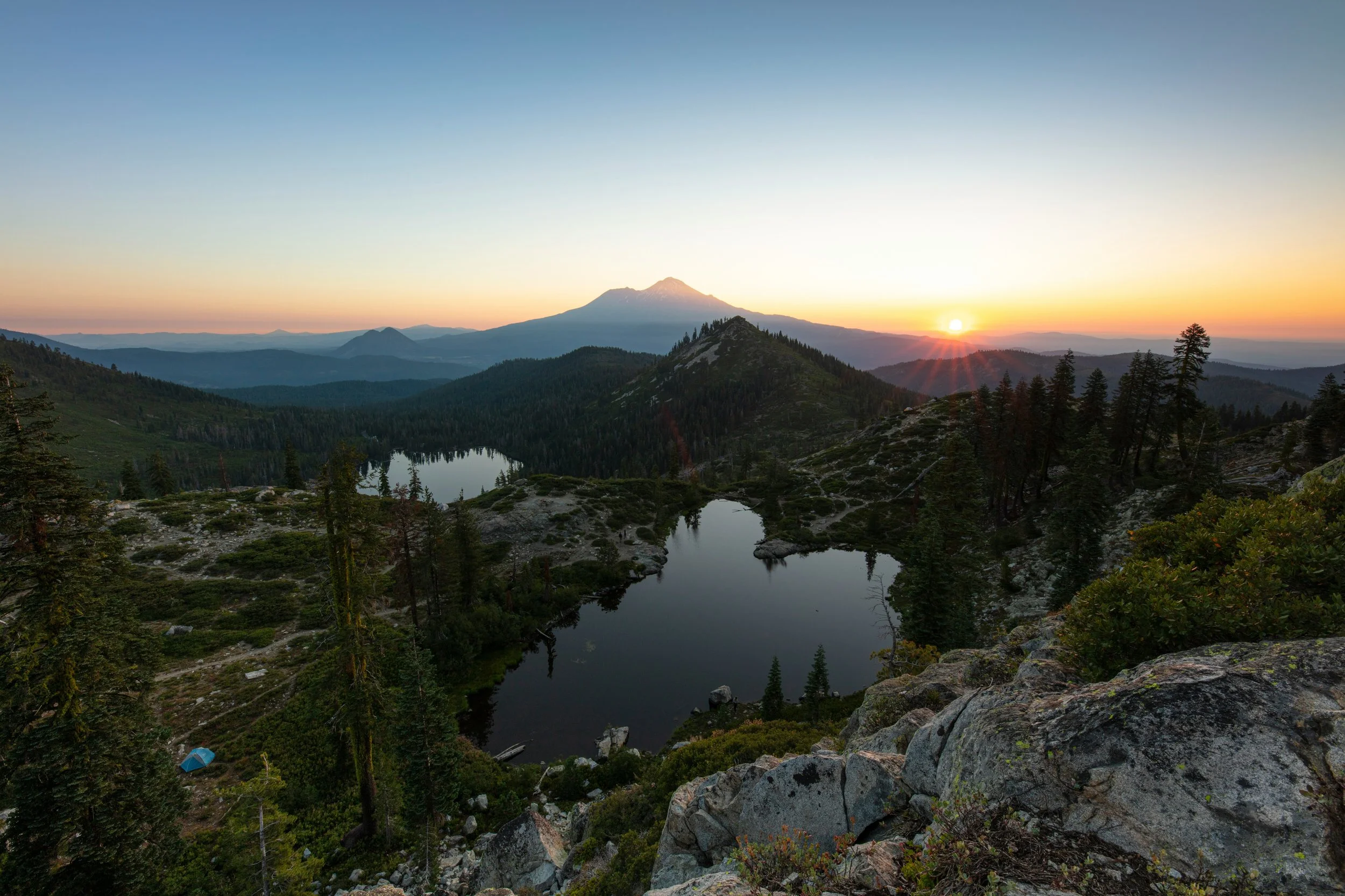
![A man stands on a trail ledge gazing out a the view of the forest and Mt. Shasta]()
Hiking
Just 3 miles south of Dunsmuir, Castle Crags State Park offers 28 miles of trails, including a section of the Pacific Crest Trail. Highlights include the accessible Vista Point Trail with views of Castle Crags and Mt. Shasta, the gentle Root Creek Trail, river access for fishing, and a scenic suspension bridge.
Mt. Shasta, a 14,179' glacier-cloaked volcano, offers everything from extreme climbs to tranquil meadow walks, catering to all ability levels.
The Lake Siskiyou Trail loops around a scenic reservoir with views of Mt. Shasta and Mt. Eddy; the full loop is accessible May–October, while partial hikes are available year-round.
The Castle Lake to Heart Lake hike is a short but rewarding trek with panoramic views of Black Butte, Mt. Shasta, and beyond.
Pluto’s Cave, a lava tube north of Shasta, allows for a 1,200-foot underground hike without a permit. Come prepared—no food, pets, fires, or water sources on site.
-
![Hedge Creek Falls waterfall is streaming over a rocky face creating a rainbow spray.]()
Waterfalls
Hedge Creek Falls: A picturesque 35-foot waterfall that cascades over a basalt cliff into a serene pool below. A unique feature of this waterfall is the shallow cave behind it, allowing visitors to walk directly behind the falling water—a rare and delightful experience. The trail to the falls is short and family-friendly, approximately 0.7 miles round trip with about 100 feet of elevation gain. Along the trail, hikers are treated to views of lush forest scenery, and the path continues past the falls to an observation deck overlooking the Sacramento River and Mount Shasta.
Faery Falls: Just northwest of Dunsmuir, this picturesque 40-foot waterfall is tucked away in a mossy, forested canyon. The hike to the falls is about 1.3 miles round trip and passes the ruins of the historic Ney Springs Resort. The trail has a mystical atmosphere, which complements the waterfall’s name.
Burstarse Falls (Lower & Upper): Located in Castle Crags Wilderness, south of Dunsmuir, Lower Burstarse is a smaller cascade visible from the trail. Upper Burstarse is a stunning waterfall (around 100+ feet) reached via a moderately challenging hike of about 5 miles round-trip. The trail leads through lush forest and offers views of the Crags. Best seen in spring or after heavy rain, as it can dry up in summer.
McCloud Falls (Lower, Middle, Upper): Located along the McCloud River, east of Mount Shasta (about 15 miles from Dunsmuir). Lower Falls: A wide, 15-foot cascade flowing into a popular swimming hole. Middle Falls: The most dramatic, at about 50 feet high and very wide, with excellent viewing platforms and access to the base. Upper Falls: A narrower but tall chute-like fall dropping into a gorge. A scenic 4-mile round-trip trail connects all three falls along the river.
-
![A skier with a backpack is skiing down a powder filled mountain side with a view of the cascades.]()
Winter Sports
Mt. Shasta Ski Park: Mt. Shasta Ski Park offers an exciting mix of downhill skiing, snowboarding, and tubing, with breathtaking views of Mt. Shasta as the backdrop. With trails for all skill levels, night skiing, and a welcoming atmosphere, it's a great spot for winter adventure. Warm up in the comfortable lodge with awesome food & beverages and visit the mountain shop for all your winter fun needs.
Mt. Shasta Nordic Center offers groomed cross-country ski trails and packed, delicate snowshoe trails on the slopes of Mt. Shasta.
The Mt. Shasta Ice Rink is one of the few outdoor rinks on the West Coast and the largest outdoor rink between Portland and Sacramento. It has a view of Mt. Shasta during the day and stars at night.
Snowman’s Hill is a designated sledding hill at the Snowman’s Hill Pass on CA Highway 89 between I-5 and McCloud. Depending on the winter snowfall, sledders can visit the hill through May. The average run length is 300 feet, perfect for people looking for a fun sledding or tobogganing experience. There is ample parking, bathrooms and crowds of happy sledders!
Fun Factory Snowmobile Rentals & Tours offers access to 300+ miles of beautiful groomed snowmobile trails, and thousands of acres in the Tri Forest Snowmobile Trail System. Mt. Shasta and the surrounding mountain ranges offer some of the BEST snowmobiling California has to offer! From beginner to advanced, guided, unguided and to-go, a snowy winter wonderland adventure awaits you on the trails of Mt. Shasta!
-
![Man is fly fishing in the Sacramento River]()
Fishing
Fly Fishing the Upper Sac: Avid fishermen from all over the world come here to fish the Upper Sacramento River, a 35-mile freestone stream flowing directly through Dunsmuir. Known for its wild rainbow trout, the river offers diverse fishing conditions, including riffles, runs, and pools. It's accessible year-round, with various hatches occurring throughout the seasons. The river is also historically significant as the birthplace of "short-line nymphing," a popular fly-fishing technique .
Lake Siskiyou: Located near Mount Shasta, Lake Siskiyou is a picturesque spot ideal for both shore and boat fishing. Anglers can expect to catch rainbow trout, largemouth bass, and other species. The lake's clear waters and surrounding scenery make it a favorite among locals and visitors alike.
Castle Lake: A high-elevation glacial lake, Castle Lake offers a serene fishing experience amidst stunning alpine surroundings. It's known for its populations of brook and rainbow trout. The lake is accessible during the warmer months and provides opportunities for both fly and spin fishing.
McCloud River: East of Dunsmuir, the McCloud River is another excellent trout fishery. It's renowned for its beautiful scenery and healthy populations of rainbow and brown trout. The river's clear waters and diverse habitats make it a must-visit for fly fishing enthusiasts
Additional Fishing Locations: Beyond these primary spots, the Dunsmuir area is surrounded by numerous other fishing opportunities, including:
Shasta Lake: A vast reservoir offering diverse fishing experiences, particularly for those with access to a boat.
Trinity Lake: Known for its clear waters and variety of fish species.
Dwight Hammond Reservoir: A lesser-known spot providing a tranquil fishing environment .
-
![Man is making a golf putt in front of Mt. Shasta on the golf course.]()
Golfing
Awe-inspiring vistas form the backdrop for golfers in Siskiyou County. Visitors to Dunsmuir have four golf courses to choose from — all within a quick drive from town.
Mount Shasta Resort Golf Course: An 18-hole course just 6 miles from Dunsmuir, this beautifully maintained course offers scenic views of Mount Shasta and challenges for all levels.
McCloud Golf Club: A relaxed 9-hole course about 7.5 miles away. Great for a casual round with mountain views.
Weed Golf Club: Located 16.6 miles from Dunsmuir, this 9-hole course is friendly and welcoming, perfect for a laid-back game.
Lake Shastina Golf Resort: Features both a championship 18-hole course and a 9-hole Scottish Links course, located about 21 miles north.


The Best Water on Earth
Dunsmuir is Home of the Best Water on Earth. This distinction comes from our region’s pure, glacier-fed springs and pristine mountain streams that flow directly from volcanic aquifers and the snowmelt of the surrounding wilderness. The water here is so clean that it's piped untreated from the source to local taps. With this unparalleled natural resource, it’s no wonder the lakes, rivers, and streams surrounding Dunsmuir are equally exceptional—offering crystal-clear waters, stunning alpine scenery, and endless recreational opportunities.

Alpine Lakes
Siskiyou County is home to over 250 named lakes, along with numerous unnamed ones. These waters—fed by glacial melt, mountain springs, and forest streams—offer breathtaking beauty and unmatched clarity.
Lake Siskiyou is a 430-acre reservoir formed by the Box Canyon Dam on the Sacramento River. It’s a favorite for swimming, boating, and fishing, with family-friendly beaches and mountain views.
Castle Lake is a 47-acre glacial lake located just north of Dunsmuir. Surrounded by alpine peaks, it offers hiking trails leading to Little Castle Lake, Heart Lake, and the Castle Crags Wilderness.
Medicine Lake is a high-elevation lake nestled in a volcanic caldera, known for its serene setting, camping, and abundant wildlife.
Lake Shastina lies along the banks of the town of Lake Shastina and features calm waters ideal for paddling, fishing, and quiet reflection.
Shasta Lake, the largest reservoir in California, extends 34.8 miles and was formed by the Shasta Dam on the Sacramento River. Located south of Dunsmuir, it’s a hub for houseboating, watersports, and fishing.
Tule Lake National Wildlife Refuge covers 39,116 acres east of Mount Shasta. Established in 1928, it is a vital habitat for migratory birds, with open water, croplands, and exceptional birdwatching.
Gumboot Lake is a small alpine lake located west of Mount Shasta near Gumboot Saddle. Tucked in the Trinity Divide, it's ideal for picnics, non-motorized boating, and a peaceful wilderness experience.
Cliff Lake is a remote gem in the Trinity Divide, accessible by trail. Known for its dramatic rock walls and turquoise water, it’s a rewarding destination for hikers and backcountry swimmers seeking solitude.
Sacramento River
Ready to discover some amazing swimming holes? This guide provides details on each spot, including size, location, unique features, and red flags.
Dunsmuir Botanical Gardens/City Park: Walk the trail upstream of the restrooms, down the hill, and right on the northbound trail to several swimming holes. Features shaded areas, large rocks, and park facilities nearby.
The Wall (Dunsmuir): From Bee Kind Bakery, turn left onto Butterfly Ave, cross the bridge, and park 1/2 mile down on the right. Short walk to the hole. Close to town, with a picnic table nearby.
Soda Creek (4 miles south of Dunsmuir): Exit I-5, park by the bridge, and walk upstream to the hole. Easy access, with a moving current.
Cantara Loop (5 miles north of Dunsmuir): Scenic, easy access with a beach. Directions: Take Dunsmuir Ave north to Mott Rd, continue 5 miles, turn left onto Contara Rd, and park 1 mile down. Walk upstream 1/8 mile to the hole.
Conant (10 miles south): Take the Conant exit, park facing the tracks, and walk 100 yards downstream to the swimming hole. Private, with great rock formations for jumping.
Sims (15 miles south): Exit I-5 at Sims, park by the bridge, and walk 1/4 mile upstream. Below cascading riffles, shaded with a rock beach.
Gibson (20 miles south): Exit I-5, park by the creek, and follow trails to the river. Long flowing pool with shelves for jumping and snorkeling.
Lamoine (25 miles south): Exit I-5, park atop the hill, and walk 300 yards down a 4WD road to the swimming hole. Solitude, sandy beach, and great for kids.
Volmers/Delta (27 miles south): Exit I-5, park near the tracks, and follow the trail to the river. Cliff walls, sandy beach, and slow water.
Dog Creek (27 miles south): Exit I-5, drive 2 miles on Fender Ferry Rd, park, and follow trails downstream to the swimming hole. Quiet, rocky beach with slow-moving water, ideal for kids.
